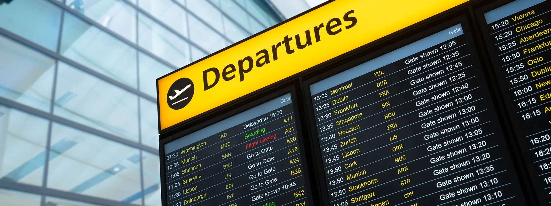
Every day, over 12 million people fly by plane all over the world. This is a very significant figure that has a direct and indirect impact on many sectors of society, generating a large amount of jobs and business.
All these passengers move between the more than 42,000 airports and aerodromes that exist in the world, half of which have regular commercial activity. This involves the existence of a series of concepts, standards, protocols and common procedures that allow this activity to be carried out safely and efficiently.
Passengers and air transport professionals use codes to refer to airports and make them simpler to identify. Find out how they work.
One aspect to consider out of all the information that passengers have to deal with is the airport designation.
The airport name, the one we typically use to refer to it, is not subject to any specific technical criteria. It usually reflects, first of all, its local or regional designation, although in many cases it is accompanied by the name of an illustrious person from the area or of some historical reference. For political, cultural or social reasons, sometimes the name of the airport is changed, or an honorific is appended to it that ends up creating designations that are frankly unusable.
Over the course of the 20th century, as the bright future of air transport came into focus, two organisations emerged that took part in several important changes:
On the one hand, IATA, the International Air Transport Association, was created in 1919 as an instrument of cooperation between airlines, and had as its main objectives the promotion of key aspects such as the safety, reliability, trust and economics of air transport.
On the other hand, ICAO, the International Civil Aviation Organization, was created in 1944 (Chicago Convention) as a specialised agency of the United Nations. Its goals and objectives are to develop the principles and techniques of international air navigation, establish common principles to carry out the activity and promote the organisation and development of air transport worldwide.
In 1947, once the Second World War came to an end and as the significant and sustained increase in air transport became evident, IATA proposed using a three-letter code to standardise airport names for commercial purposes, thus facilitating the processes of booking flights, identifying tickets, flight schedules and baggage handling systems.
The goal was for air traffic to be more efficient, more technically controlled in certain aspects of its operation, and comfortable for workers in the industry and for passengers.
If you look at a boarding pass, the three-character IATA codes of the origin and destination airports, which can sometimes seem random or quirky, feature prominently. But they’re not really random.
In most cases, the code consists of a combination of letters corresponding to the large city or metropolitan area served by the airport.
When possible, the first three letters of the name of the main city where the airport is located are used. This designation, which is the most intuitive, is evident in the cases of Madrid (MAD), Mexico (MEX), Guatemala (GUA), Amsterdam (AMS) and Vienna (VIE).
But it’s not always going to be that simple. On other occasions, the code uses a combination of letters contained in the name of the city, such as Ibiza (IBZ), Santiago de Cuba (SCU), Chihuahua (CUU), Prague (PRG) or Florence (FLR). This combination sometimes does not include the first letter, as in the case of Quito (UIO), Cork (ORK), Almería (LEI) and Marrakesh (RAK).
Sometimes the code includes an additional random letter that has nothing to do with the name, such as Los Angeles (LAX), Seville (SVQ), Birmingham (BMX), Málaga (AGP), Dubai (DXB) or Calgary (YYC).
Sometimes, airports take the name of the smallest town, neighbourhood or area where they are located. Such is the case with Ezeiza in Buenos Aires (EZE), and Orly, the region of Paris (ORY).
Finally, there are airports whose code comes from the initials of the famous person they are named after. Notable examples include John F. Kennedy Airport in New York (JFK) and Charles de Gaulle Airport in Paris (CDG).
Since the goal is for each airport to have a unique identifier, when it is not possible to create it in any of these ways, planners resort to other alternatives, such as combining letters of the city and country, adding another unrelated letter, or even going with a unique name. Among the latter, the case of Jerez airport in Spain is particularly notable, since its code is XRY, a reference to the typical local wine, sherry.
Another curious case is the airport of the city of San Sebastián, located in the municipality of Hondarribia, but whose IATA code is EAS, which comes from Easo, the city’s name two centuries ago.
Ultimately, the goal is to make it easy to identify commercial airports. There are currently around 20,000 IATA codes, a little over a hundred of which are repeated, although they are usually small aerodromes of little significance and no important connections.
As for ICAO codes, they have four letters and their mission is more technical.They are essential for managing flight operations, air traffic control and route planning.
The make-up of these codes is more technical; they also relate almost entirely to the airport’s geographical location, but they are special in that no two codes are the same.
The first letter identifies the region, a group of countries or one particularly large country: Such is the case with southern Europe (L), central-northern Europe (E), Canada (C), the United States (K), southern Africa (F), South America (S), etc.
The second letter refers to the country, and is usually the first letter in that country’s name, save for a few exceptions.
Finally, the last two letters identify the city where the airport is located.
In cases where the airport lacks an ICAO code, ZZZZ is generally used for its designation.
ICAO codes are the most commonly used by air transport and navigation professionals, essentially because they cannot be duplicated. As for the IATA codes, us passengers typically use them to see if we’re on the right route or not.


