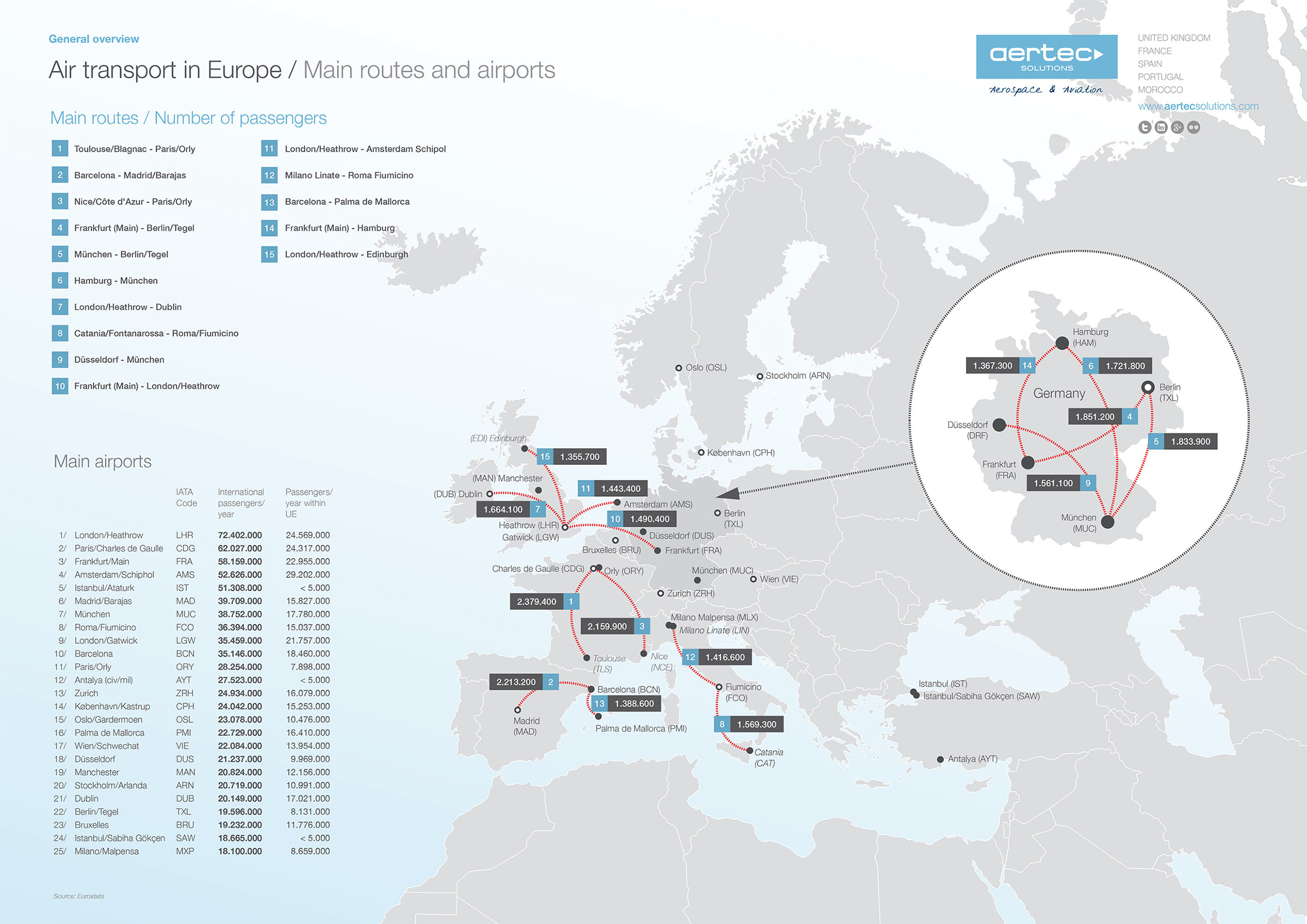
The world of figures and statistics is exciting, and air transport is no exception. On this occasion our aim is to show details of the main routes and airport infrastructures in Europe using a map. The idea is to give you an insight into how it is possible for so many millions of people to travel large distances with ease, especially this time of year.
Putting all the data down on paper, some interesting facts come to light. For example, almost half of the ten most frequently used routes in Europe are within Germany, despite the fact it has only two top-ten continental airports (Frankfurt & Munich). It is also worth pointing out that twelve of the top fifteen routes are domestic.
The airport that handles the most European passengers is Amsterdam-Schiphol, even though it is currently in fourth place in terms of overall worldwide passenger traffic, with London-Heathrow, Paris-Charles de Gaulle and Frankfurt-Main in front. And while we’re on the subject of London, this city has three airports all in the top 12 with the most passenger traffic in Europe. As you can see, putting the statistics on paper is always interesting.
This information corresponds to last year, when many airlines and airports were still being affected by the financial recession. This year, 2014, it looks like there has been a positive trend in almost all areas, so we can expect improved figures. In a few weeks we will update this information and compare it to this infographic. Please feel free to download and share it as much as you like.
[wpfilebase tag=file id=476 tpl=download_yellow /]
Source: Eurostats
The contents of this document are intellectual property of AERTEC Solutions. Any copy or diffusion is allowed as long as it is integrally done to the document and preserves at all times AERTEC Solutions’ trademark.


