In recent years, there has been a remarkable acceleration in the development of unmanned aerial systems, UASThe new technology, which has affected all segments of this novel industry, is expected to grow significantly. In fact, significant growth is expected from those used for home entertainment to those for surveillance or national defence.
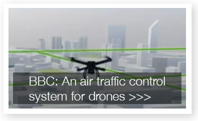
Soon we will have hundreds of unmanned aerial systems flying over each of our cities, and traffic control systems will need to be properly designed to fly smoothly and safely.
In recent years, the market has made an effort to develop more efficient and better performing aircraftThis has gone hand in hand with a diversification and specialisation The choice of models depends on the purpose for which they are to be used. For example, a rotor drone used for filming has nothing in common with a fixed-wing drone used for observation of large geographical areas.
As this sector has only recently emerged, the navigation of the devices has so far not been a serious problem. The legislation developed in most countries has focused on determining the capabilities of those operating the devices, while some aspects have been regulated on the requirements needed to fly over certain areas or the restrictions that affect others (airports, military zones, protected areas, official buildings, etc.).
The problem we are likely to encounter in the next few years will be the inexorable trend towards the massive use of UAS for distribution, courier or even human transportation. These uses, on the other hand, will take place in both urban and rural areas, so it will be necessary to go much further than merely developing a legislative framework. It will be necessary to define, create and implement complex air navigation systems for UAS.
 The difficulties are not few, as it will be necessary to harmonise technical navigability, environmental, administrative and geopolitical criteria.
Among the technical criteria for seaworthiness In particular, those arising from the structure of the airspace in which UAS operate are worth mentioning. To begin with, we are talking about three motion vectors. The flight of dozens (or hundreds) of aircraft in the three dimensions of space requires the exact definition of the paths along which they can evolve. In addition, technical progress must make it possible to much more precise positioning of the aircraft. Current developments suggest that this will require the configuration of traffic lanes and route interchange nodes. Something similar to the current air routes for commercial aircraft, but with a higher concentration of corridors and with a greater restriction on safety distances. One of the critical points that have already been identified is the development of appropriate protocols for the automated transfer control of the aircraft between different control nodes.
At this point it will also be necessary to consider the coexistence of existing air traffic with the emerging UAS traffic.
 If we look at the criteria related to the environment Inexorable consideration must be given to the environmental impact of UAS in both urban and rural environments. Without going into technical details, let's take as an example the acoustic impact generated by any UAS. What would be the noise level of just a dozen drones passing over our street? What if it is a livestock farm? Obviously, we will have to move towards quieter aircraft, while navigability criteria will have to expressly limit the heights and distances in each case.
Among the administrative criteria it will be necessary to clearly envisage which department has the appropriate competences to define the details of air navigation in each specific environment. Given that UAS will mostly fly within cities, it does not seem logical to think of a body in charge of regulating global navigation, but rather, for reasons of logic and scale, it will be necessary for the regional or local administrations themselves to deal with the specific design of the routes in each case. All of this, obviously, following aeronautical criteria compatible with commercial flights and with inter-regionally agreed parameters.
Finally, it will also be necessary to take into account the geopolitical criteria to adapt in each case the national legislations and the restrictions that each state imposes on this type of aircraft and its circulation.
Already, several countries and organisations are developing solutions to try to anticipate what the control of autonomous UAS navigation will entail.
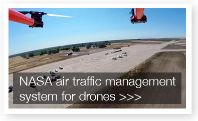
 One of the most forward-thinking on this issue has been NASA, which is adapting familiar concepts of air navigation to the specific case of UAS. The proposal is called UTM (Unmanned Aircraft System Traffic Management) and covers concepts for the design of airspace, corridors, nodes, weather controls, etc.
One of the fundamental assumptions being considered is the fact that RPAS flight will be automatedSo it makes sense that air traffic control should be too.
Similarly, the UTM environment shall require the registration of any aircraft entering the system.and the identification of those that are not. This will be a fundamental element for the safe use of RPAS and their relationship with the environment and the population.
Other entities, such as Vodafone or Nokia, have also detected a business niche and are trying to reach agreements to adapt their networks for UAS monitoring and control.
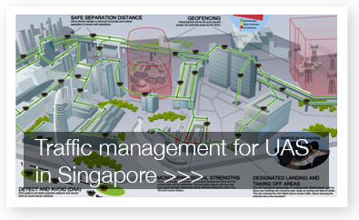
Administrative entities such as the Government of Singapore or SESAR (Single European Sky ATM Research) have working groups looking for or developing real solutions to UAS navigation control in their specific areas of competence. For their part, technology corporations such as Simulyze or General Atomics have also been working for years on tools for the navigation control of unmanned aircraft.
What is certain is that, at the same time as these attempts to standardise air navigation are emerging, UAS are already fostering the development of various economic activities which should not be affected by a delay in the development of navigation systems (as well as legislation) that would allow these aircraft to evolve through the air efficiently and safely.
(1) Unmanned Aircraft System