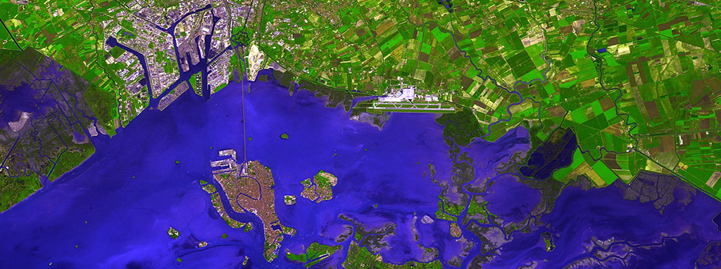
Airports are environments where millions of passengers congregate on a daily basis. There is intense activity at any time of day at the hundreds of airports spread out across the world, where infrastructures, services, people and processes coexist. Furthermore, this coexistence has to take place under some very strict safety and security standards.
All governments without exception consider airports as strategic infrastructures. Due to all this, it is essential for airport managers to be equipped with effective tools that allow them to successfully manage all the elements involved in their daily work. This isn’t all, however. They also have to provide useful information to third parties that might need it on a timely basis (emergency services, security forces, public administrations, etc.).
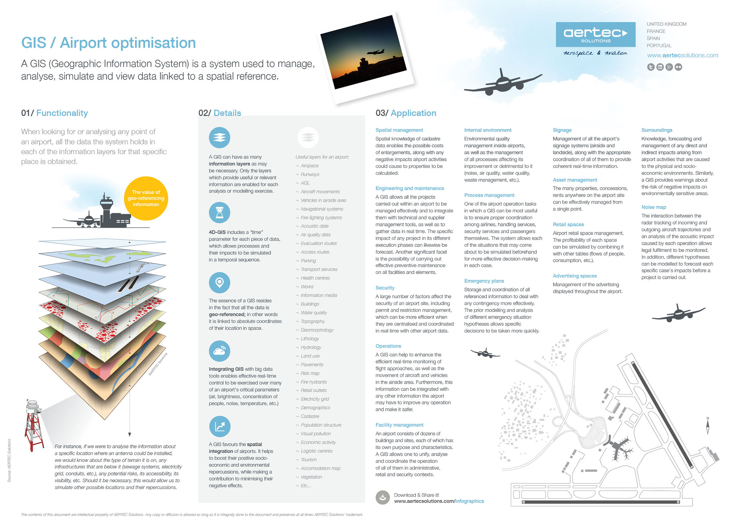
One of the tools that has turned out to be most effective to carry out this enormous workload of knowledge and coordination at airport facilities and their surroundings are GIS (Geographic Information Systems).
A GIS is a tool (hardware + software) that serves to manage, analyse, simulate and view geographically referenced data. In other words, it is an enormous database where any kind of information can be introduced, provided each piece of data thus entered has coordinates that can locate it in space.
Now then, let’s envisage any airport. Let’s think about all the available data on it which can be geo-referenced. Now let’s imagine the enormous possibilities that combining all this data would offer us. We propose a series of questions that a properly configured airport GIS loaded with data could answer:
Which is the quickest way of reaching a specific area of the airport in the rush hour? Where do bottlenecks happen? At what time? Are there any gates or corridors that can become bottlenecks?
In which direction should the airport grow to ensure its noise impact is as low as possible? Which land is more suitable for an enlargement?
What are the most popular restaurants at the airport? Which routes do passengers take to reach them? How many food shops are there along the way? And vending machines?
Where is the fire hydrant with the most water located to extinguish a small fire in a specific area? Which is the quickest way to reach it?
Furthermore, we can even create simulations on the evolution of infrastructures over time if the “time” parameter is added to the referenced data. We can also speed up or slow down these simulations to view the evolution of processes which would otherwise be imperceptible.
This infographic demonstrates some of the most relevant characteristics and uses of geographic information systems at airports. How many other new applications can you think of?
[wpfilebase tag=file id=849 tpl=aertec-downloads /]
Source: Our company
The contents of this document are intellectual property of AERTEC Solutions. Any copy or diffusion is allowed as long as it is integrally done to the document and preserves at all times AERTEC Solutions’ trademark.